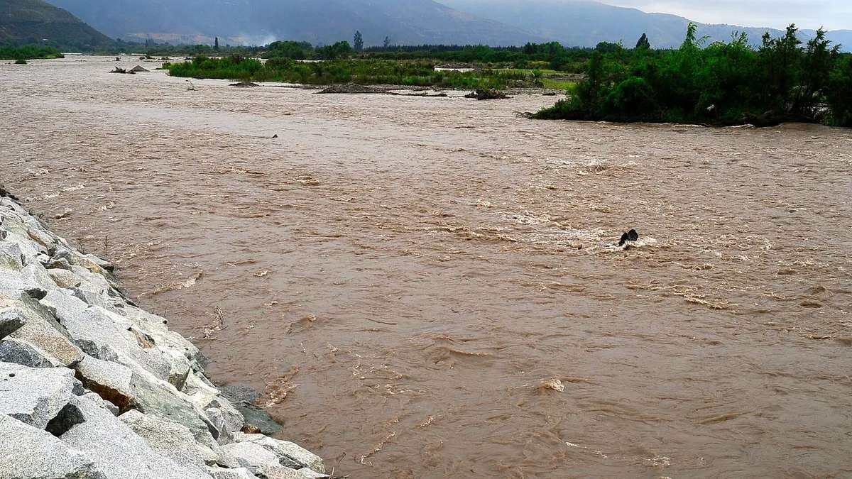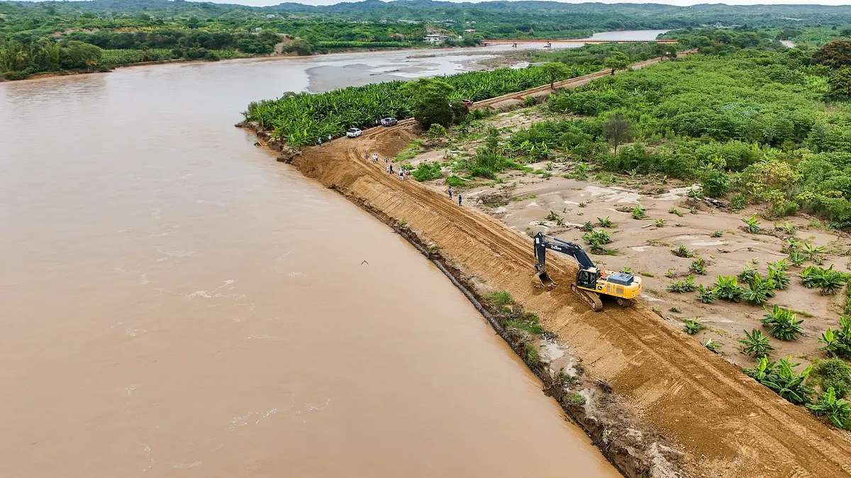
The Tumbes River, in Peru's far north, exceeded the red hydrological alert threshold on Tuesday, November 17, 2026: at the El Tigre station, in the San Jacinto district, the flow peaked at 1,387.59 cubic meters per second (m³/s), when the danger level is 1,000 m³/s, according to Senamhi data cited by La República. By 10:00 a.m. the flow had fallen to 1,136.98 m³/s, still in the red. Senamhi told RPP it is the highest of the season and a new surge in the coming days cannot be ruled out.
The surge is explained by heavy rain in the basin, which is binational: the river rises in Ecuador, where it also rained hard, and flows through Tumbes to the sea. It is the Tumbes River's third red-level episode in 2026, amid a coastal El Niño that ENFEN describes as extraordinary in magnitude. This article brings together the Tumbes River flow by the hour, the exposed communities, earlier episodes and what to do if you live near the riverbed.
View the data as a table
| Peak flow at El Tigre | 1,388 m³/s |
| Red threshold | 1,000 m³/s |
| Above the threshold | 38.8% |
| Cabo Inga flow at 6:00 a.m. | 1,078 m³/s |
Tumbes River flow today: how it rose in a few hours
At 4:00 a.m., El Tigre read 840.83 m³/s, above the 800 m³/s orange threshold, and Senamhi warned it could reach the highest level in the following hours, Infobae reported. That is what happened: in the morning the river went well past 1,000 m³/s and touched 1,387.59 m³/s. Upstream, at the Cabo Inga station, where the basin enters Peruvian territory, the flow was 1,077.88 m³/s at 6:00 a.m. According to RPP, the rise took place overnight and in the early morning, and then the trend turned downward.
| Alert level at El Tigre | Flow | What it means |
|---|---|---|
| Yellow | 600 m³/s | High flow: monitor |
| Orange | 800 m³/s | Risk of overflow in low-lying areas |
| Red | 1,000 m³/s | Danger: possible overflows and flooding |
El Tigre station thresholds according to Senamhi, cited by Infobae and Andina. Flow figures are preliminary and may differ between outlets: RPP reported "about 1,300 m³/s".
Areas at risk from the Tumbes River surge
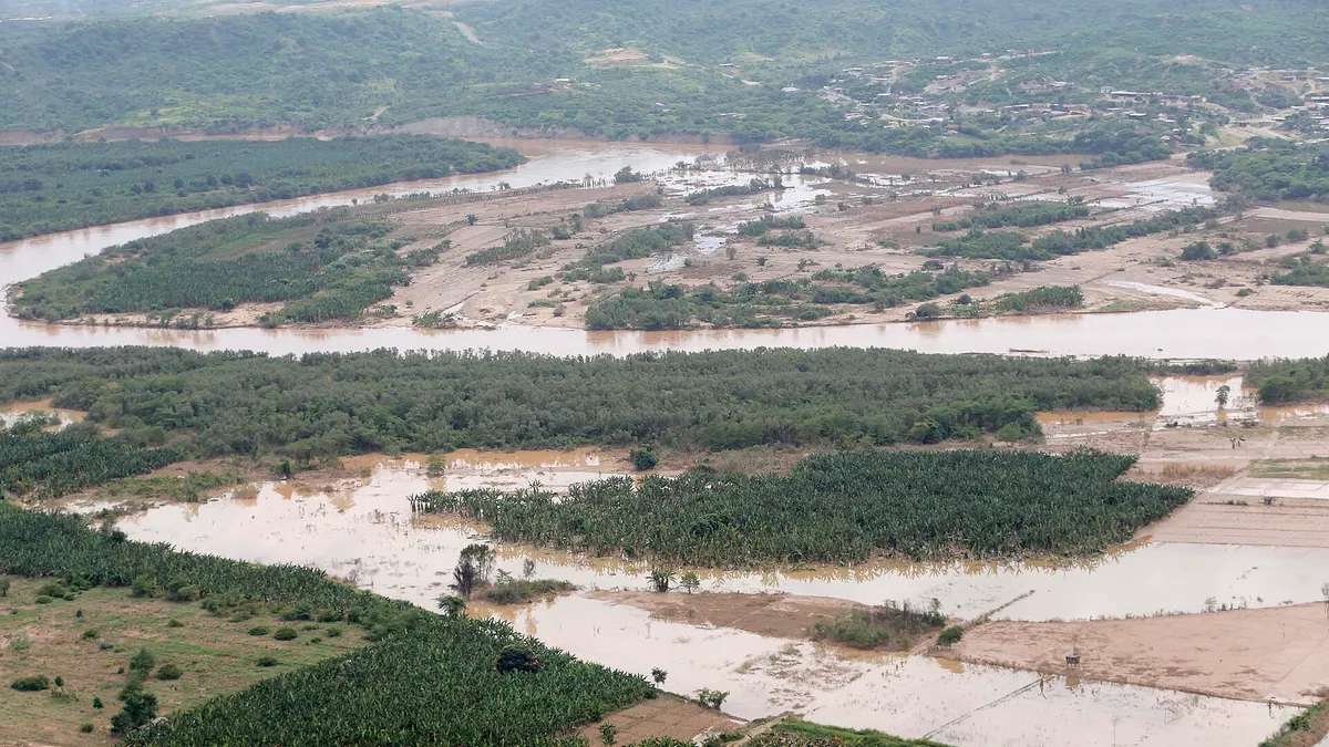
According to Peru's National Civil Defense Institute (Indeci), cited by La República, the sectors exposed to overflows are El Prado, Carretas, Oidor, Pampas de Hospital, Tumbes, Tacural, Cabo Inga, Rica Playa and La Capitana, along the riverbanks between San Jacinto, Pampas de Hospital and the city of Tumbes. Contralmirante Villar province is also affected: in the Casitas district, the Casitas-Bocatán ravine left about 10 communities with nearly 1,500 people with access problems, and the Army moved residents and supplies in trucks, Infobae reported.
| Place | Situation | Source |
|---|---|---|
| Tumbes riverbanks (9 sectors) | Exposed to overflows | Indeci |
| Casitas (Contralmirante Villar) | ~10 communities and ~1,500 people with access cut off | RPP |
| Zarumilla River | 242 m³/s; aid to 100 families | Zarumilla municipality |
| El Ciruelo (Ayabaca, Piura) | 71.1 mm of rain in two hours | Senamhi |
Sources: La República; Infobae.
The Tumbes River in the red: the 2026 episodes
It is not the first time this year. On February 19, the Tumbes River reached 1,181.35 m³/s at El Tigre and Civil Defense identified 15 communities at risk, according to Andina. On November 2 it crossed the red threshold again, with 1,021.33 m³/s at 5:00 a.m. (Senamhi hydrological warning No. 1667), while the Zarumilla River overflowed and affected more than 300 families in Puerto Perú, in Aguas Verdes, according to Caretas. The November 17 flow is the highest of the three.
| Date | Peak flow at El Tigre | What happened | Source |
|---|---|---|---|
| Feb 19, 2026 | 1,181.35 m³/s | 15 communities at risk; the Chira and Alamor rivers also in the red | Andina |
| Nov 2, 2026 | 1,021.33 m³/s | Warning No. 1667; Zarumilla overflow in Puerto Perú (more than 300 families) | Caretas |
| Nov 17, 2026 | 1,387.59 m³/s | Season high; 9 sectors exposed | La República |
- Feb 19, 2026Tumbes River in the red: 1,181.35 m³/s
- Mar 2026Coastal El Niño begins, according to ENFEN
- Oct 2026October rains exceed those of 1982-83 and 1997-98 in Tumbes
- Nov 2, 2026Tumbes River in the red and Zarumilla overflow
- Nov 13, 2026ENFEN keeps the coastal El Niño alert
- Nov 17, 2026Season high: 1,387.59 m³/s
- Feb 2027El Niño would remain extraordinary in magnitude
The backdrop is a coastal El Niño of extraordinary magnitude. ENFEN expects it to stay that way until February 2027 and to weaken gradually until mid-2027, with above-normal rain on the north coast and high flows in the Tumbes, Chira and Piura rivers, according to Gestión. In Tumbes, October rains were unprecedented for that time of year and exceeded those of the 1982-1983 and 1997-1998 El Niños, according to Senamhi as cited by Andina. To understand the phenomenon, see what ENFEN says about the extraordinary coastal El Niño and how much it could cost Peru's economy.
What to do during the Tumbes River alert
Authorities recommend, according to La República:
- Stay away from the riverbanks and avoid any activity near the river.
- Do not try to cross ravines, channels or flooded areas, on foot or by vehicle.
- Follow official reports from Senamhi, Indeci and COER Tumbes.
- Follow the authorities' evacuation instructions and keep an emergency backpack with water, a flashlight, documents and medicine.
- Call 115 (Civil Defense) or 105 (Police) in an emergency.
115 and 105 are the emergency numbers for Civil Defense and Peru's National Police. If you follow natural hazards in the country, also see how many earthquakes Peru has had in 2026.
Frequently asked questions
What is the Tumbes River flow today?
On November 17, 2026, it peaked at 1,387.59 m³/s at El Tigre and read 1,136.98 m³/s at 10:00 a.m., above the 1,000 m³/s red threshold, according to Senamhi.
What is the Tumbes River red threshold?
1,000 m³/s at the El Tigre station. Orange is 800 m³/s and yellow 600 m³/s.
Which areas are at risk?
According to Indeci: El Prado, Carretas, Oidor, Pampas de Hospital, Tumbes, Tacural, Cabo Inga, Rica Playa, La Capitana.
Why is the Tumbes River rising?
Because of heavy rain in its basin, shared with Ecuador, linked to the extraordinary coastal El Niño affecting northern Peru since March 2026.