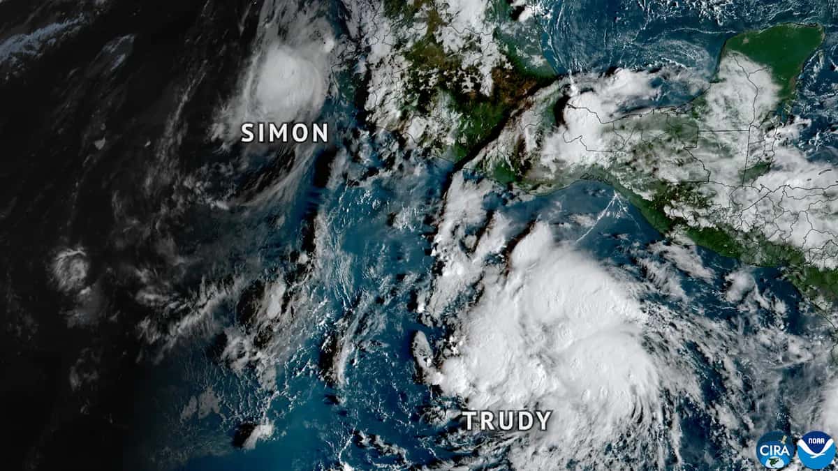
Hurricane Trudy is moving northwest off Mexico's Pacific coast and will pass very close to Colima and Jalisco between Saturday night, October 17, and Sunday, October 18, according to advisory No. 16 from the [U.S. National Hurricane Center (NHC)](https://www.nhc.noaa.gov/text/MIATCPEP1.shtml), issued at 3 a.m. Central Mexico time. At that time it had maximum sustained winds of 150 km/h (90 mph), category 1, and the Government of Mexico had a hurricane warning in effect from Manzanillo to Cabo Corrientes.
The data in this article come from that advisory. A hurricane changes hour by hour: for safety decisions, follow the advisories of Mexico's National Meteorological Service (SMN) and each state's Civil Protection agency.
Where Hurricane Trudy is and where it is heading
| Item (3 a.m. advisory, Central Mexico time) | Value |
|---|---|
| Location | 16.0° north, 103.4° west |
| Distance from Acapulco | 385 km (240 mi) west-southwest |
| Distance from Manzanillo | 345 km (215 mi) south-southeast |
| Maximum sustained winds | 150 km/h (90 mph), with higher gusts (category 1) |
| Movement | Northwest at 13 km/h (8 mph) |
| Minimum central pressure | 979 mb |
| Hurricane-force winds extend | Up to 55 km from the center |
| Tropical-storm-force winds extend | Up to 220 km from the center |
The NHC expects Trudy to keep heading northwest through Saturday and Sunday, approach the coast of southwestern and west-central Mexico and pass near it Saturday night into Sunday. It would then turn west-northwest and move away from the coast early next week.
Hurricane Trudy warnings along Mexico's coast
| Type of alert | Area | What it means |
|---|---|---|
| Hurricane warning | Manzanillo northward to Cabo Corrientes | Hurricane conditions expected; tropical-storm winds from Saturday |
| Hurricane watch | South of Manzanillo to Punta San Telmo | Hurricane conditions possible from late Saturday |
| Tropical storm warning | South of Manzanillo to Zihuatanejo | Tropical storm conditions expected on Saturday |
| Tropical storm warning | North of Cabo Corrientes to Punta Mita (new) | Tropical storm conditions expected |
| Tropical storm watch | North of Punta Mita to San Blas, and the Islas Marías | Conditions possible from Sunday |
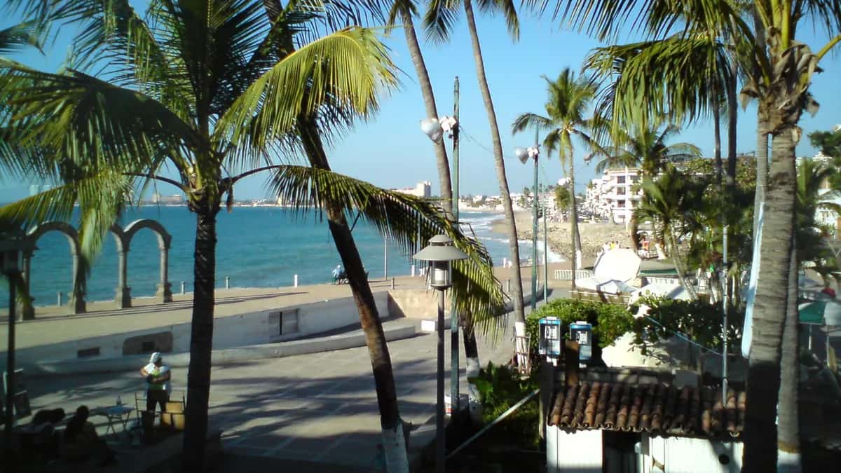
The NHC warned that more watches or warnings will likely be needed on Saturday. The Government of Mexico added the warning from Cabo Corrientes to Punta Mita, which includes the Puerto Vallarta area, in the overnight advisory.
Rain and surf: what Hurricane Trudy could bring
Water, not wind, is usually the biggest threat to people. The NHC expects these rainfall totals through the weekend:
| States | Expected rainfall | Risk |
|---|---|---|
| Michoacán, Colima and Jalisco (coast and nearby areas) | 100 to 200 mm (4 to 8 in), isolated totals around 380 mm (15 in) | Life-threatening flooding and mudslides, especially on steep terrain |
| Guerrero and Nayarit (coast) | 50 to 100 mm (2 to 4 in), isolated totals around 150 mm (6 in) | Localized flash flooding |
In addition, swells generated by Trudy are already affecting the coast of southwestern Mexico and will spread northward through the weekend, causing life-threatening surf and rip currents. Near the coast, storm surge with large and destructive waves is possible in areas of onshore winds. The SMN and Conagua had forecast waves of 4 to 5 meters in Guerrero and Michoacán, according to UnoTV.
How strong it could get
The NHC does not rule out some strengthening on Saturday while Trudy remains over warm water. Its intensity forecast, converted to km/h and Central Mexico time, is:
| Time | Forecast maximum winds | Approximate category |
|---|---|---|
| Saturday 17, noon | 165 km/h (105 mph) | Category 2 hurricane |
| Sunday 18, midnight | 165 km/h (105 mph) | Category 2 hurricane |
| Sunday 18, noon | 155 km/h (100 mph) | Borderline category 1-2 |
| Monday 19, midnight | 130 km/h (80 mph) | Category 1 hurricane |
| Monday 19, noon | 100 km/h (65 mph) | Tropical storm |
From Sunday afternoon, increasing wind shear and drier air would weaken the system, which would become a post-tropical remnant low by day 4 and dissipate by day 5, according to the NHC forecast discussion.
| Category (Saffir-Simpson scale) | Sustained winds |
|---|---|
| 1 | 119 to 153 km/h (74 to 95 mph) |
| 2 | 154 to 177 km/h (96 to 110 mph) |
| 3 | 178 to 208 km/h (111 to 129 mph) |
| 4 | 209 to 251 km/h (130 to 156 mph) |
| 5 | 252 km/h (157 mph) or more |
How Trudy formed
Trudy formed as a tropical storm south of Mexico early in the week, according to CNN en Español, and strengthened quickly: on October 15 the SMN expected it to reach category 2, according to La Jornada. Some Mexican media reported on Friday that it had reached category 3; in the NHC advisory early Saturday it appears with 150 km/h winds, typical of category 1. At the same time, a cold front was bringing heavy rain to central and eastern Mexico, according to Infobae.
Safety tips
- Follow official advisories from the SMN, Civil Protection and the NHC; do not rely on audio messages or images without a source.
- If you live on a hillside, near a river or in a low-lying coastal area, identify your temporary shelter and an evacuation route.
- Do not cross flooded streets or streams, on foot or by car.
- Keep water, a flashlight, a radio, medicines and documents in a waterproof bag.
- Stay away from beaches and the sea while surf warnings are in effect.
If you are traveling to Mexico's Pacific coast this weekend, check with your airline or hotel. To plan further ahead, see Mexico's mandatory rest days in 2027.
Frequently asked questions
Where will Hurricane Trudy hit?
The NHC expects it to pass very close to the coast of Colima and Jalisco between Saturday night, October 17, and Sunday, October 18, with a hurricane warning from Manzanillo to Cabo Corrientes. It does not forecast a direct hit at a specific point.
What category is Hurricane Trudy?
In the 3 a.m. Saturday advisory it had 150 km/h winds, category 1. The NHC does not rule out it reaching category 2 on Saturday.
How much rain will it bring?
Between 100 and 200 mm on the coast of Michoacán, Colima and Jalisco, with isolated totals around 380 mm, according to the NHC.
Does it affect Puerto Vallarta?
The area from Cabo Corrientes to Punta Mita has been under a tropical storm warning since early Saturday.
When will it weaken?
The NHC expects weakening from Sunday afternoon and the storm to move away from the coast early next week.